Syria Vegetation Index: August 2025
The August 2025 edition of Syria Vegetation Index reveals a nationwide year-over-year drop in median NDVI (Normalized Difference Vegetation Index) levels, a measure used to assess vegetation health, density and coverage.
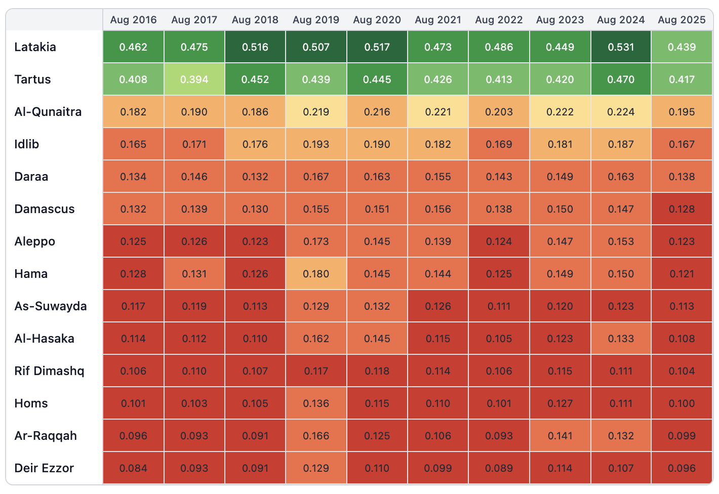
Heatmap of Median NDVI levels per Governorate: August (2016 - 2025)
Key Highlights
Nationwide Decline: All 14 of Syria's governorates recorded a Year-over-Year (YoY) decrease in median NDVI levels, with declines ranging from 6.3% to 25%.
Most Affected Governorates: Ar-Raqqah (-25%), Aleppo (-19.6%), and Hama (-19.3%) recorded the steepest YoY declines in vegetation health.
Least Affected Governorates: Rif Dimashq (-6.3%), As-Suwayda (-8.1%), and Homs (-9.9%) registered the smallest, though still significant, YoY declines.
Request Access
The complete dataset, which includes monthly data from February 2000 through August 2025, is available upon request. You can request access by filling out the inquiry form on our product page.
About This Product
Syria Vegetation Index is a satellite-derived data product by Syria From Above. It tracks monthly vegetation health trends across Syria at the governorate, district, and subdistrict levels—available from 2000 to the present.
Acknowledgment
Syria Vegetation Index uses open-access data provided by the National Aeronautics and Space Administration (NASA) and the OpenStreetMap (OSM) community. It is intended for informational purposes only.